
Temperatures predicted to remain cold for January.
I hope you all had wonderful Christmas. December turned out to be a rather benign month weather-wise with the continuation of above-average temperatures and below-average rainfall. This month, however, we are likely going to see a whole new ball game, with a long-lasting winter shift across the east and southeast United States. There could be some “interesting” times ahead.
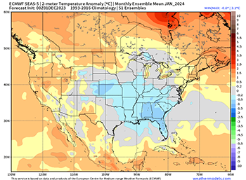
Earlier winter forecasts were calling for an area of low pressure to develop over the east and southeast, bringing cold and snow to parts of the country. The new long-range models are showing this too. If you look at the accompanying graphic, you can see a lot of blue across the East. That’s the cold air being pulled down.
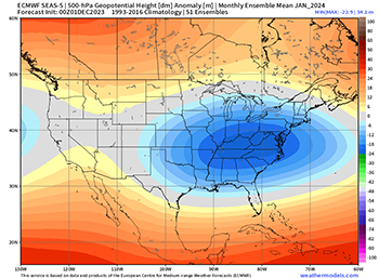 Now let’s address the elephant in the room. Will this mean snow for the Southeast? We do believe the cold air will be in place. I believe the moisture will be in place too! The track of the sub-tropical jet stream with El Nino is a mega-moisture transport system and precipitation is expected to be above normal. So, cold air, abundant moisture, and away we go!
There is also another issue we need to be aware of. This particular jet stream pattern creates strong wind shear. Preceding our southern cold fronts will be storms, some severe, very likely producing small tornadoes. Let us all be weather aware this month.
Happy New Year to you all.