Some of the most significant pieces of the proposed 30-mile Highlands to Islands Trail network has now been approved with some segments in place.
More than 25 years ago when greenways were beginning to get a foothold in Georgia, some forward-thinking ecologically minded Hall Countians envisioned a trail spanning the oblong county. During the intervening years similar multi-use pedestrian and bike paths sprouted in Atlanta, Roswell, Alpharetta, Kennesaw, and Marietta where the Atlanta Beltline, Big Creek Greenway, Silver Comet Trail, and numerous other trails now host throngs of fitness buffs, recreation seekers, and commuters on paved paths seen as major economic amenities and quality of life enhancements.
In Hall County, the idea hatched a quarter century ago has inched forward. Local option sales tax funding, a significant private donation, and a development boom have recently fueled perhaps some of the most significant pieces of the proposed 30-mile Highlands to Islands Trail network. In November, a web of trailblazers launched a website to help citizens keep up with trail news. The site, www.highlandstoislands.org, posts interactive updated trail maps, events, and various places trail followers may like to visit. It is the latest output from a long-time partnership between Hall County, the Gainesville-Hall Metropolitan Planning Organization, Greater Hall Chamber of Commerce, and the cities of Flowery Branch, Gainesville and Oakwood, the entities collaborating to forge the trail.
While a virtual trail visit might be informative, feet on the ground allow a more useful assessment of what’s going on. For now, be prepared to put those feet inside a motor vehicle for much of the route between Lake Lanier’s Longwood Cove in Gainesville on the north end and Margaritaville at Lanier Islands in Buford on the south side.

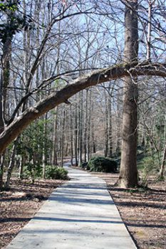
Walkways wind through wooded areas like this one, a part of Midtown Greenway – Rock Creek Greenway, near downtown Gainesville.
At the northern terminus Gainesville pedestrians have for decades loved what many still call the “Scaled Down Mini-Solar System Trail,” a paved path that passes models of the Sun and planets between the Downtown Square through Rock Creek, Ivy Terrace, Wilshire and Longwood parks. The near two-mile path has been rebranded as the Rock Creek Greenway connecting Lake Lanier with the Gainesville Square.
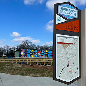
Perhaps the most exciting segment of the Highlands to Islands network lies just south of the Gainesville Square across the white-banistered pedestrian bridge over Jesse Jewell Parkway. In mid-January the former “bridge to nowhere” led to the still-under-construction Solis Gainesville, a 223-unit mixed use apartment community. The mud footing the bridge’s south end last month may be paved by spring, offering a solid connector between the old growth trees and babbling waters of the Rock Creek Greenway and the more recently paved Midland Greenway. It’s also easy to cross between the Midland Greenway and Gainesville Square without stepping foot on the bridge via the crosswalk at Main Street and Jesse Jewell. Just proceed past the Wild Wing Café and facility next door to meet the concrete path.
The urban greenway allows an interesting peek at brick-and-mortar edifices of Gainesville’s early 20th century architecture and industry on a former railroad bed. Engine 209, a historic locomotive that formerly rested on the other side of Jesse Jewell Parkway, features prominently in the soon-to-open Train Park. By the end of February, the Gainesville Parks and Recreation Department hoped to open a large plaza, playground and boardwalk, said director Kate Mattison. A “destination” handicapped-accessible adapted playground, restrooms, fitness court and lighting are in the works, Mattison said. A skate park already attracts daredevils on boards and in-line wheels. Colorful geometric abstract paintings on exterior walls beg passersby to stop and ponder.
The Midland Trail currently ends abruptly at the intersection of Pine Street and Industrial Boulevard. Highlands to Islands picks up again on Palmour Road, south of Lee Gilmer Memorial Airport, where it winds through a forest, passes behind businesses on Atlanta Highway, and extends through Chicopee Village on the most popular section. Then, it comes to another sudden dead end just beyond a tunnel under Atlanta Highway outside Department of Labor property in Oakwood. A $785,000 donation from Pilgrim’s poultry company, which has a nearby plant in Gainesville, is expected to help close a 2.5-mile gap around the airport. Design work is on-going for the route around the airport and connectors in Oakwood, said Joseph Boyd, Transportation Planning Director for the Gainesville-Hall MPO. He called the airport segment “the biggest piece,” pivotal in connecting Gainesville and Oakwood. Updates will be posted on the website, as well as news about the connector soon to be constructed between the Oakwood tunnel and the University of North Georgia Gainesville campus. “Those small connectors are the catalyst” that can put more people on the trails, said Dan Schultz Oakwood Planning and Development Director. “People don’t realize what a large effect those connectors can have.”

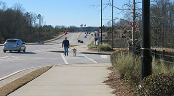
A man walks his dog on the Highlands to Islands Trail network on Friendship Road in Braselton near Northeast Georgia Medical Center.
South of Oakwood, there’s scant evidence of the Highlands to Islands Trail until travelers reach Friendship Road, where the path changes character. The 15-mile east-west segment between Braselton and Margaritaville in Buford is a concrete sidewalk along both sides of a busy thoroughfare passing restaurants, gas stations, businesses, hospital/medical complexes and residential developments. It leads past Holiday Marina and marine-oriented outlets before heading into the resort and waterpark. The 15-or-so trail miles between Chicopee Village and Friendship Road are yet to get on the ground. Construction along Spout Springs Road is bad enough for car travelers and almost impassable for anyone wanting to walk or bike. Aside from funding (trail construction costs more than $1 million per mile), the biggest challenge to completing the network is development that might cause re-design.
Although some may speculate that Hall County is hitting the trail late, some who were in on its inception disagree. “We’ve been talking about it for a long time,” said RK Whitehead, who has been part of the trail movement since about 2005. That’s when the Greater Hall Chamber of Commerce Vision 2030 Committee started a greenspace subcommittee to protect natural areas. “Clearly, trails fit that category,” said Whitehead, who has long ties with Chicopee Woods Nature Preserve and Elachee Nature Science Center. Boyd, the Gainesville-Hall MPO transportation director, noted that the fledgling Highlands to Islands Trail is indeed “more recent” than many of the well-known multi-use trails in metro-Atlanta and north Georgia. The current push for multi-use corridors, evidenced by Hall County voters willing to pay an extra penny sales tax, Gainesville’s investment in the Midland Trail, survey responders asking for more footpaths, and a private business donating a large sum, is blazing the way. But it may take a while longer.
Photos: by Alan Hope, Vicki Hope, Jane Carpenter


