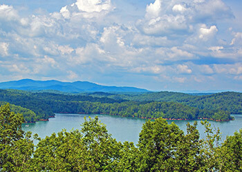
View of Carters Lake from a nearby mountain.
The area in and around Carters Lake, which is Georgia’s deepest lake, is entwined in many facets of American history … even before the coming of Europeans. Cherokees and other tribes reverently named this section of the Coosawattee River, “The Great Valley.” Though the Indians were all rounded up in this area in 1838 and force-marched along the “Trail of Tears” to reservations in Oklahoma, remnants of their existence still remain in the prehistoric village of Coosa near Carters Lake Dam.
The Spanish explorer De Soto is said to have spent more than a month in Coosa looking for gold. The area near the modern dam site was also a place where smaller battles occurred during the latter stages of the War Between the States.
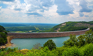
Carters Lake Dam
Carters Lake Dam was completed on the Coosawattee River by the U.S. Army Corps of Engineers in 1977 and named after a wealthy Georgian from the early 1800s: Farish Carter. Carters Lake is approximately 11 miles long covering some 3,200 acres with 62 miles of shoreline and is over 400 feet deep in many areas. It is located between Calhoun and Ellijay and 12 miles south of Chatsworth, Ga.
Carters Lake Marina is the only marina on the lake and is open throughout the year for boating needs and storage. Their website is: www.carterslake.com. Six public boat ramps are available at the lake for easy access and are located at Damsite, Doll Mountain, Woodring Branch and Ridgeway. For more information, call 706-334-2248.
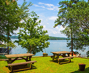
View of Carters Lake from the marina.
Several hiking trails of varying difficulty make the lake a hiking destination (search www.sam.usace.army.mil for info on trails). The Oak Ridge Nature Trail follows a high ridge to the lakeside, then returns along a creek. In just over a mile there are four distinct ecosystems. Tumbling Waters Trail (Ridgeway) takes you to one of the few remaining waterfalls in the area (many are beneath the level of the lake). Here Tails Creek twists and turns down a 50-foot cascade. The Hidden Pond Songbird Trail is an easy hike that allows you to visit the wetlands of a gentrified beaver pond, and the beaver pond itself, rich in waterfowl.
An active fish stocking program by the Georgia Department of Natural Resources along with native fish found in the lake provides diversity for anglers. Fish species include bass (largemouth, smallmouth, hybrid, striped and spotted) crappie, walleye, bream and catfish. For a detailed fishing forecast at Carters Lake go to: www.n-georgia.com.
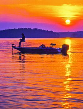
Fishing near sunset at Carters Lake.
The reregulation pool or lower lake is located below Carters Lake and can be accessed from a boat ramp near the Carters Powerhouse off Old Highway 411. This lower pool fluctuates based on powerhouse discharge. Fishing on the lower lake is peaceful because few pleasure boats operate in the shallower waters. Swift-water fishing is also possible in the Coosawattee River below the reregulation dam. Two concrete fishing decks, picnic tables, a hiking trail and bathrooms are also provided at the downstream fishing areas.
No development is permitted along the shoreline at Carters Lake, which ensures breathtaking vistas that are hard to find anywhere. This lake is a spectacular tract of foothills scenery with clear waters and rugged shoreline that provides a wonderful setting for a variety of outdoor recreation opportunities. Carters Lake is truly a Georgia Mountains gem!
Photos: by Bill Vanderford


